
165.13 Acres Along Range Road 172 High Prairie, Alberta T0G 1E0



$849,000
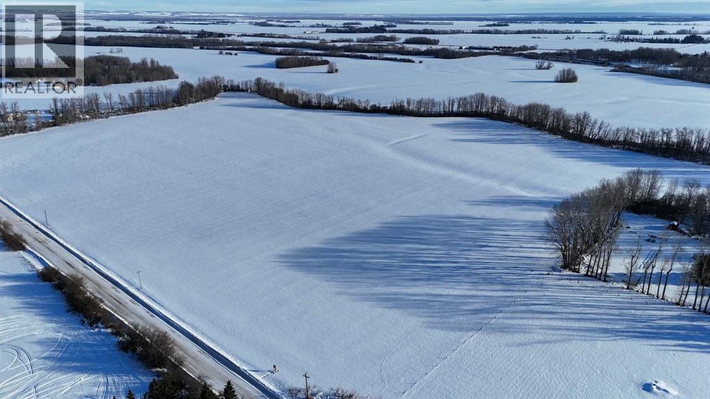
165.13 acres located within the Town of High Prairie municipal boundaries, consisting of two titles totaling approximately 141.34 acres and 23.79 acres, zoned Urban Reserve and currently in ongoing agricultural production. The land is primarily cultivated with intermittent treed areas and features the West Prairie River cutting diagonally through a portion of the property, adding natural character and landscape diversity. Urban Reserve zoning allows for continued agricultural use along with permitted uses such as accessory buildings, agriculture, greenhouse/market garden operations, public and utility uses, solar energy systems, telecommunication towers and wind energy conversion systems, with discretionary uses including campgrounds, a single dwelling unit, home occupation and RV storage facilities, subject to municipal approval. A rare opportunity to acquire a large, contiguous landholding within town limits offering agricultural utility today with long-term strategic positioning. (id:50955)
Property Details
| MLS® Number | A2286665 |
| Property Type | Vacant Land |
| Plan | 0928763 |
| Structure | None |
Building
| Age | Age Is Unknown |
Land
| Acreage | Yes |
| Fence Type | Fence |
| Size Irregular | 165.13 |
| Size Total | 165.13 Ac|161+ Acres |
| Size Total Text | 165.13 Ac|161+ Acres |
| Zoning Description | Ur |
https://www.realtor.ca/real-estate/29366949/16513-acres-along-range-road-172-high-prairie
Associate Broker
(403) 652-1798
(403) 601-6096
www.hansenlandco.com/
www.facebook.com/hansenlandbrokers
www.linkedin.com/pub/shawn-hansen-alc/3a/a04/988
www.twitter.com/hansenlandco
618 Centre Street SE
High River, Alberta T1V 1E9

The trademarks REALTOR®, REALTORS®, and the REALTOR® logo are controlled by The Canadian Real Estate Association (CREA) and identify real estate professionals who are members of CREA. The trademarks MLS®, Multiple Listing Service® and the associated logos are owned by The Canadian Real Estate Association (CREA) and identify the quality of services provided by real estate professionals who are members of CREA. The trademark DDF® is owned by The Canadian Real Estate Association (CREA) and identifies CREA's Data Distribution Facility (DDF®)
April 15 2026 07:40:39
Calgary Real Estate Board
Century 21 Foothills Real Estate
