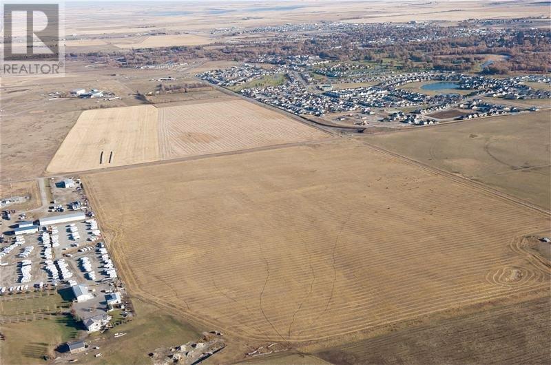
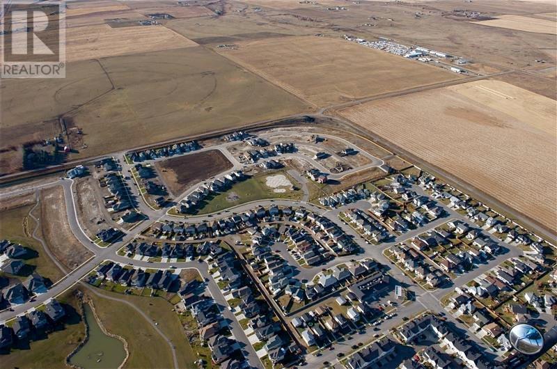
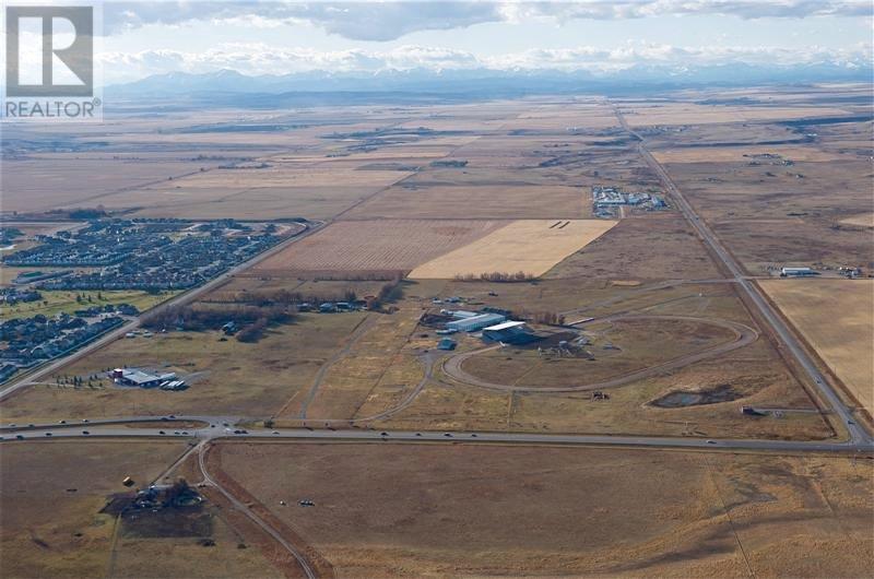
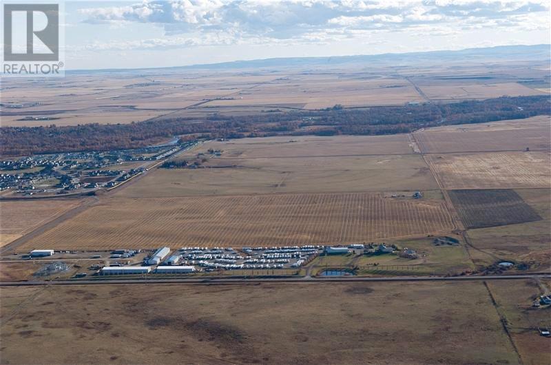
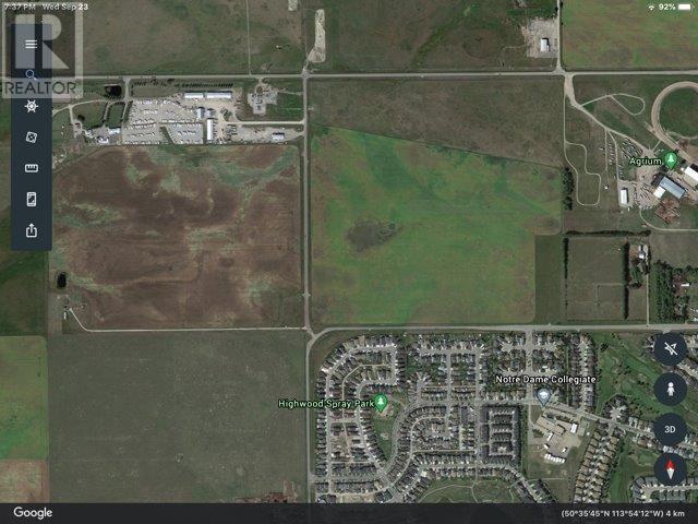
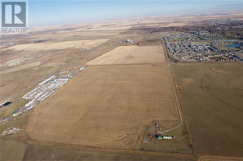
92 ACRES OF LAND FOR DEVELOPMENT IN THE NORTHWEST CORNER OF HIGH RIVER / NEXT TO HWY 549 (498 AVENUE) HWY 2 / HWY 2A / 10 MINUTES TO OKOTOKS /20 MINUTES TO SOUTH CALGARY / APPROVALS THAT ARE IN PLACE AS FOLLOWS A.S.P. (AREA STRUCTURE PLAN) / F.S.P. (FUNCTIONAL STUDY PLAN) C.S.A. (COST SHARING AGREEMENT / WITH NEIGHBOURHOOD OUTLINE PLAN ESTABLISHED / PRICED AT $85,000 PER ACRE / GREAT LAND TO DEVELOP with HIGHEST ELEVATION IN THE TOWN OF HIGH RIVER / THIS LAND HAS NEVER FLOOD / TERMS MAY BE AVAILABLE / MORE INFORMATION AVAILABLE ON REQUEST (id:50955)
MLS® Number | A2100393 |
Property Type | Vacant Land |
Community Name | Highwood Village |
Features | Other |
Plan | 1510245 |
Road Type | Gravel Road |
Age | Age Is Unknown |
Amperage | 100 Amp Service |
Utility Power | 100 Amp Service, Single Phase |
Utility Water | Well |
Acreage | Yes |
Fence Type | Cross Fenced |
Sewer | Holding Tank, Private Sewer |
Size Depth | 694.91 M |
Size Frontage | 566.9 M |
Size Irregular | 92.00 |
Size Total | 92 Ac|80 - 160 Acres |
Size Total Text | 92 Ac|80 - 160 Acres |
Zoning Description | Cr-1 |
https://www.realtor.ca/real-estate/26395051/64-street-ne-coal-trail-nw-high-river-highwood-village
No Favourites Found
The trademarks REALTOR®, REALTORS®, and the REALTOR® logo are controlled by The Canadian Real Estate Association (CREA) and identify real estate professionals who are members of CREA. The trademarks MLS®, Multiple Listing Service® and the associated logos are owned by The Canadian Real Estate Association (CREA) and identify the quality of services provided by real estate professionals who are members of CREA. The trademark DDF® is owned by The Canadian Real Estate Association (CREA) and identifies CREA's Data Distribution Facility (DDF®)